Hoh Rainforest
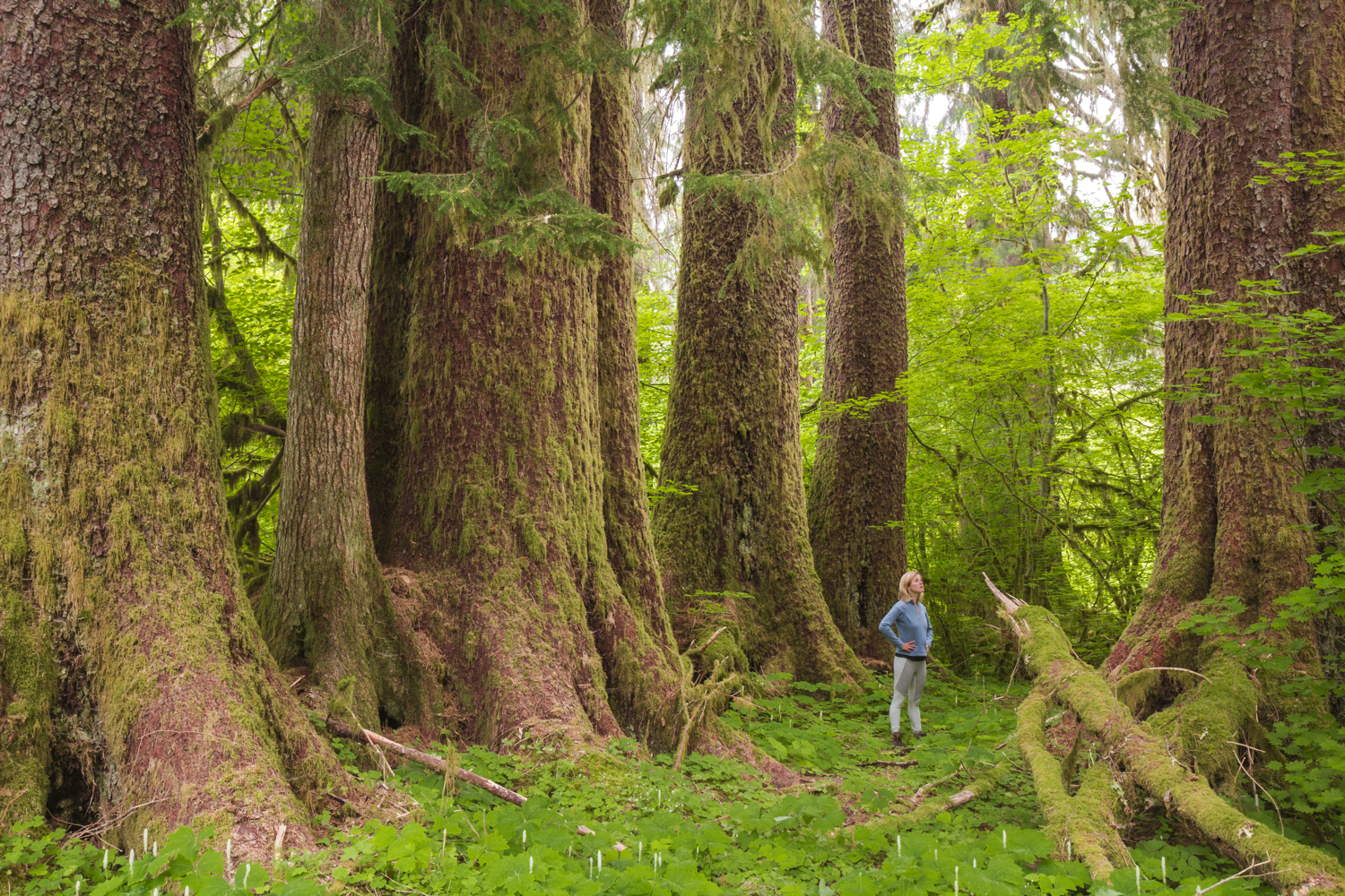
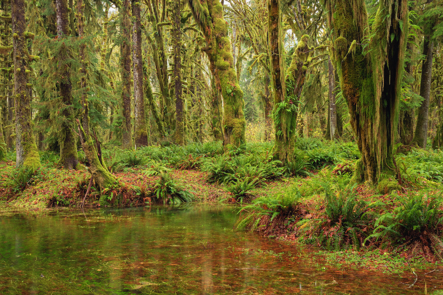
The most famous of Olympic National Park’s four rainforest valleys, the Hoh is one of the finest remaining examples of temperate rainforest in the United States and is one of the park's most popular destinations. During the winter season, the rainforest is almost always cloudy and frequently rainy. In fact, the Hoh receives a total of 140 to 170 inches (or 12 to 14 feet) of precipitation each year. The result is a lush, green canopy of both coniferous and deciduous species. Mosses and ferns that blanket the surfaces add another dimension to the enchantment of the rainforest.
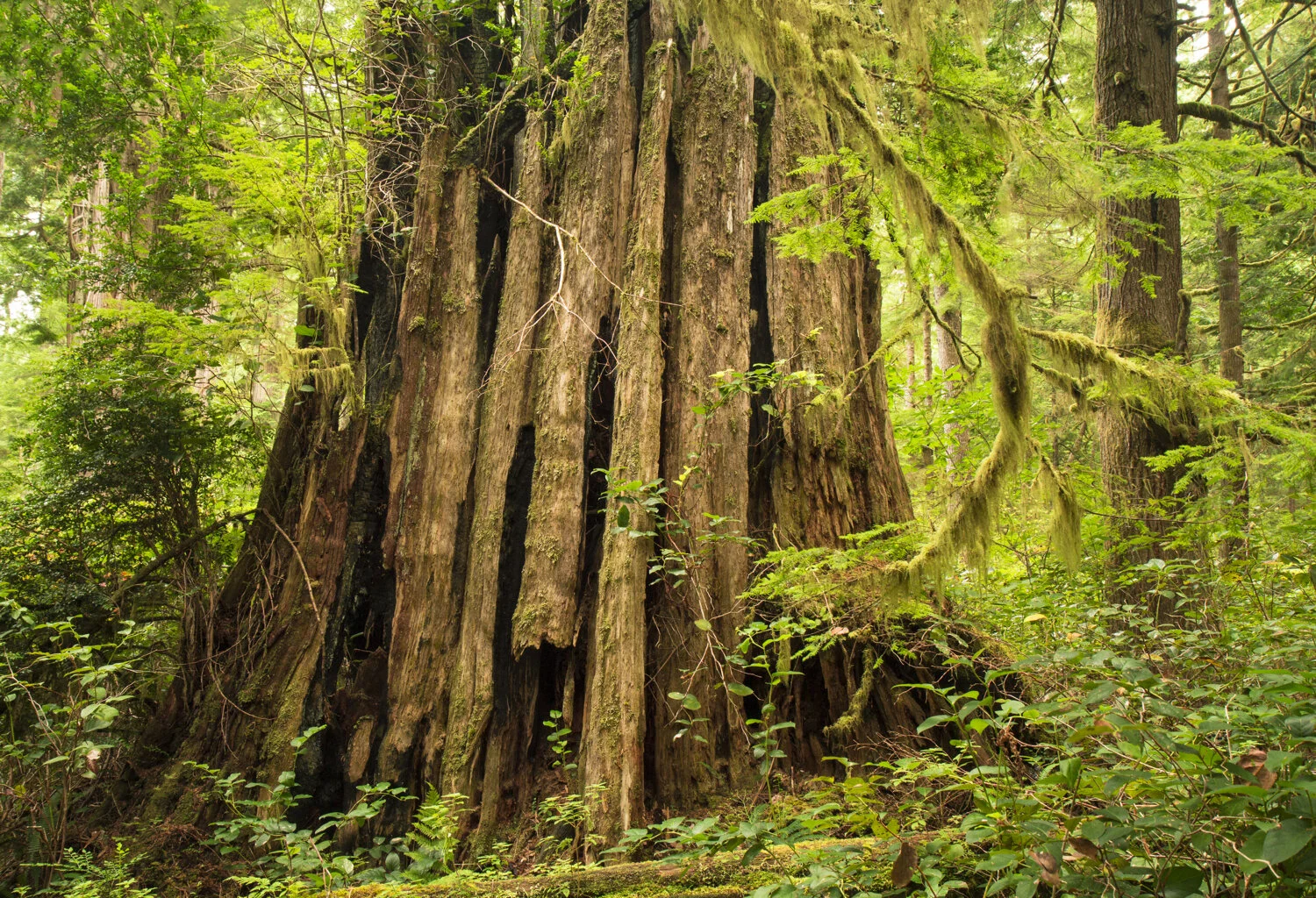
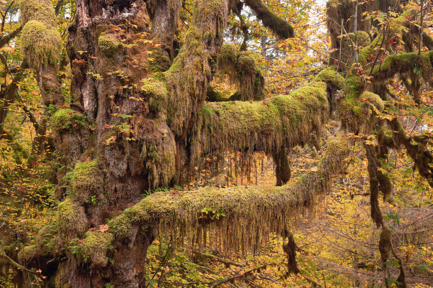
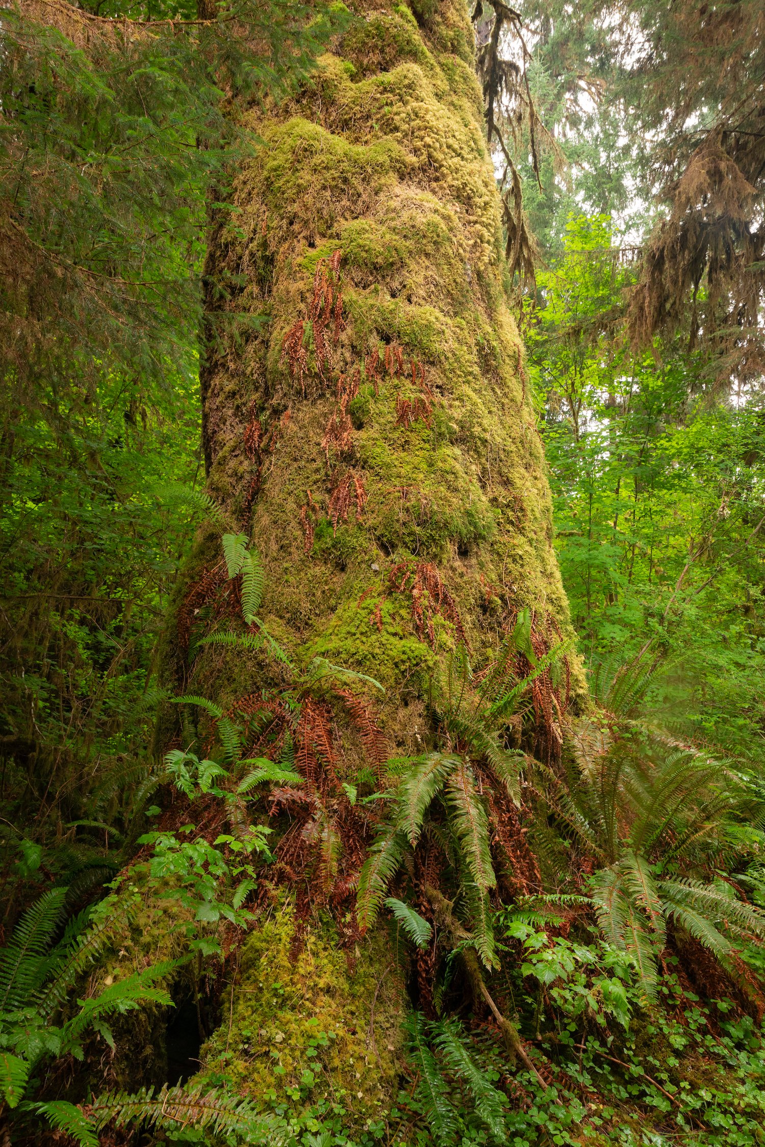
The visitor center provides access to several short trails, including the famous Hall of Mosses—an unbelievably lush grove of Sitka spruce, bigleaf maple, and western hemlock trees covered in green. Nearby, the appropriately named Spruce Nature Trail also provides a stunning sample of the moss-laden scenes typical of the Hoh. The rainforest is also home to the Preston Macy Tree, formerly the sixth-largest Sitka spruce tree in the world, now in a state of natural decomposition.

Hall of Mosses

Hall of Mosses

Spruce Nature Trail

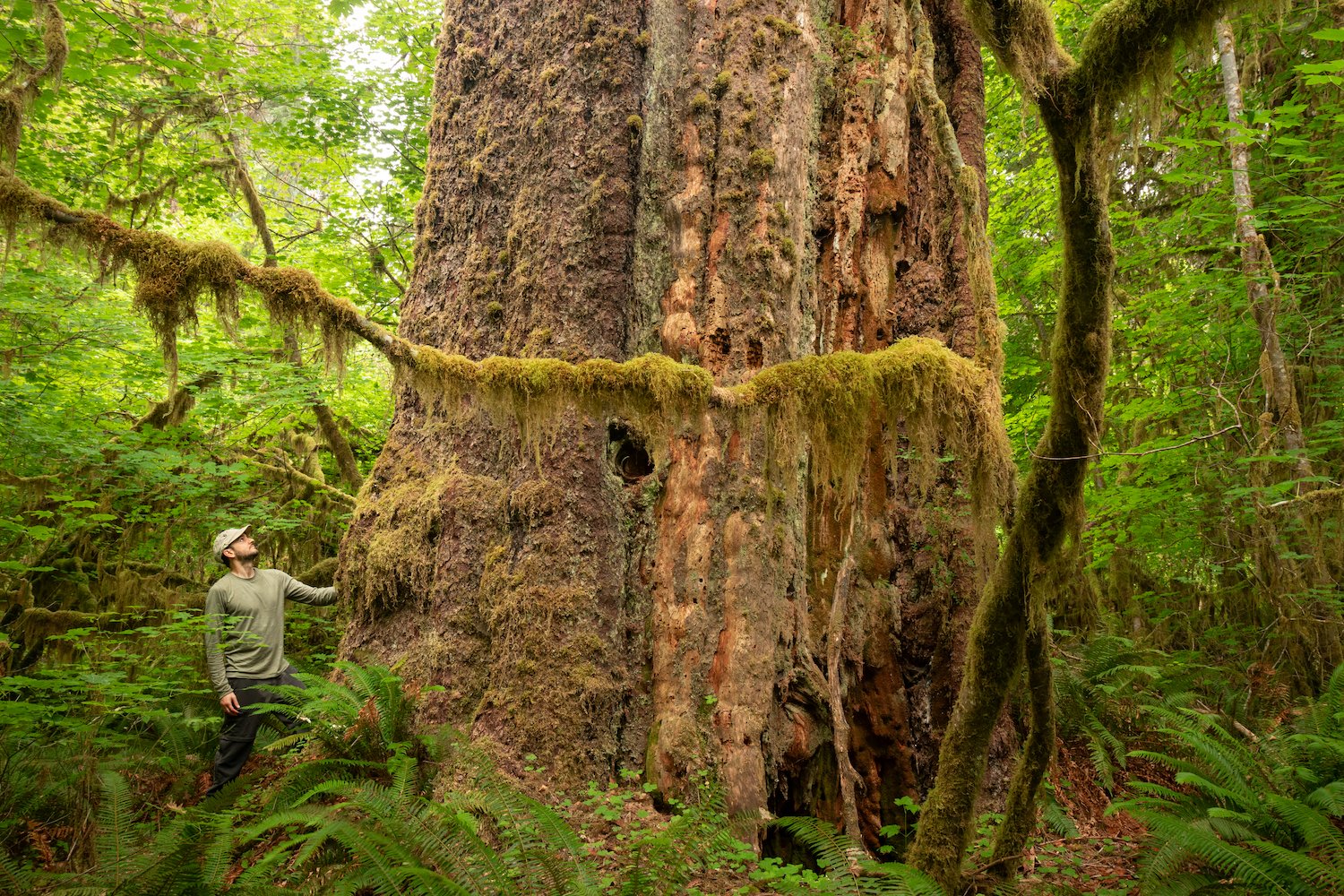
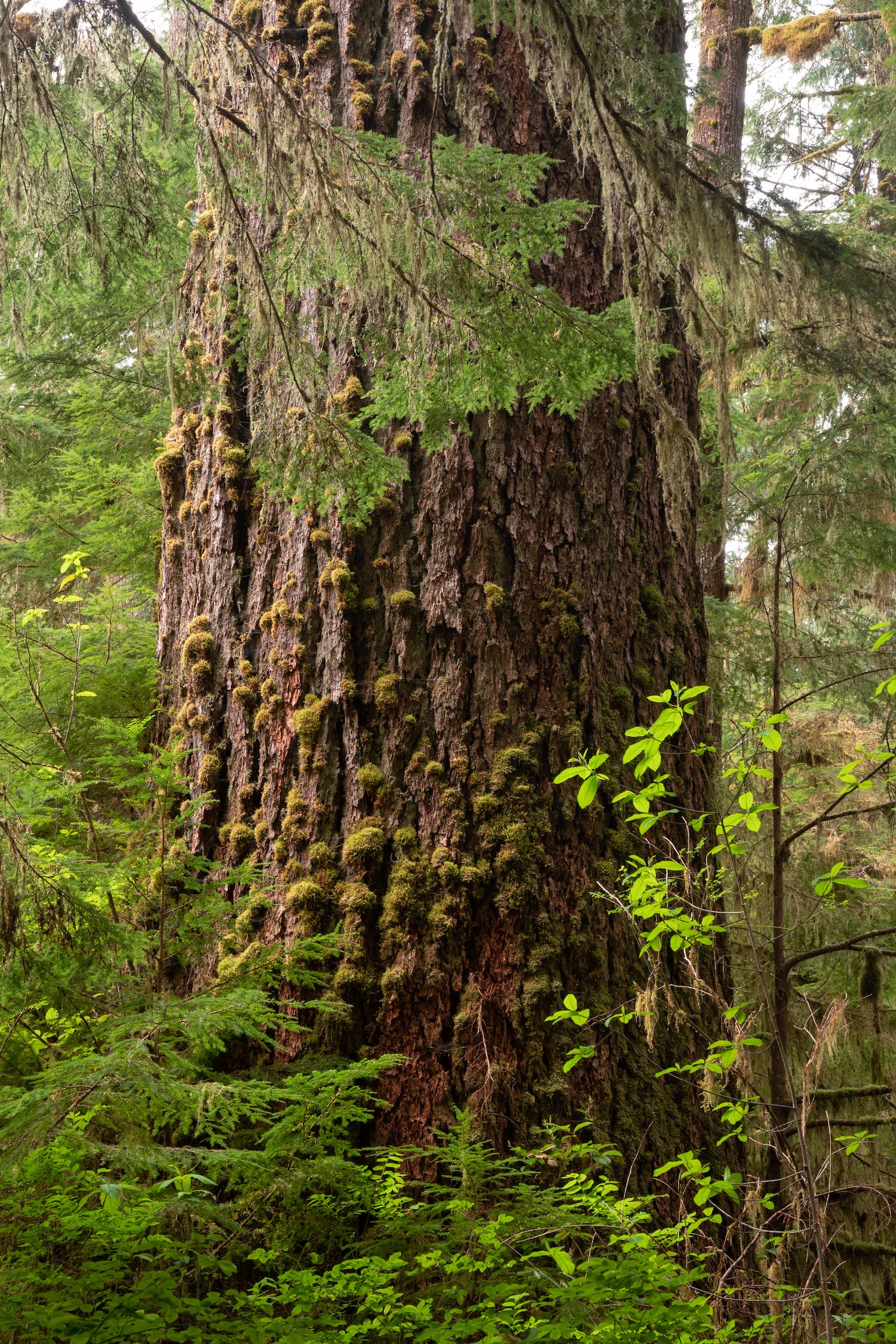
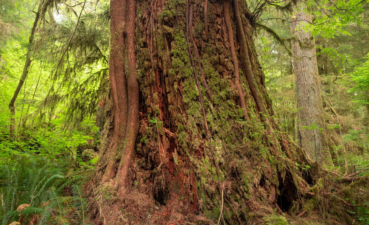
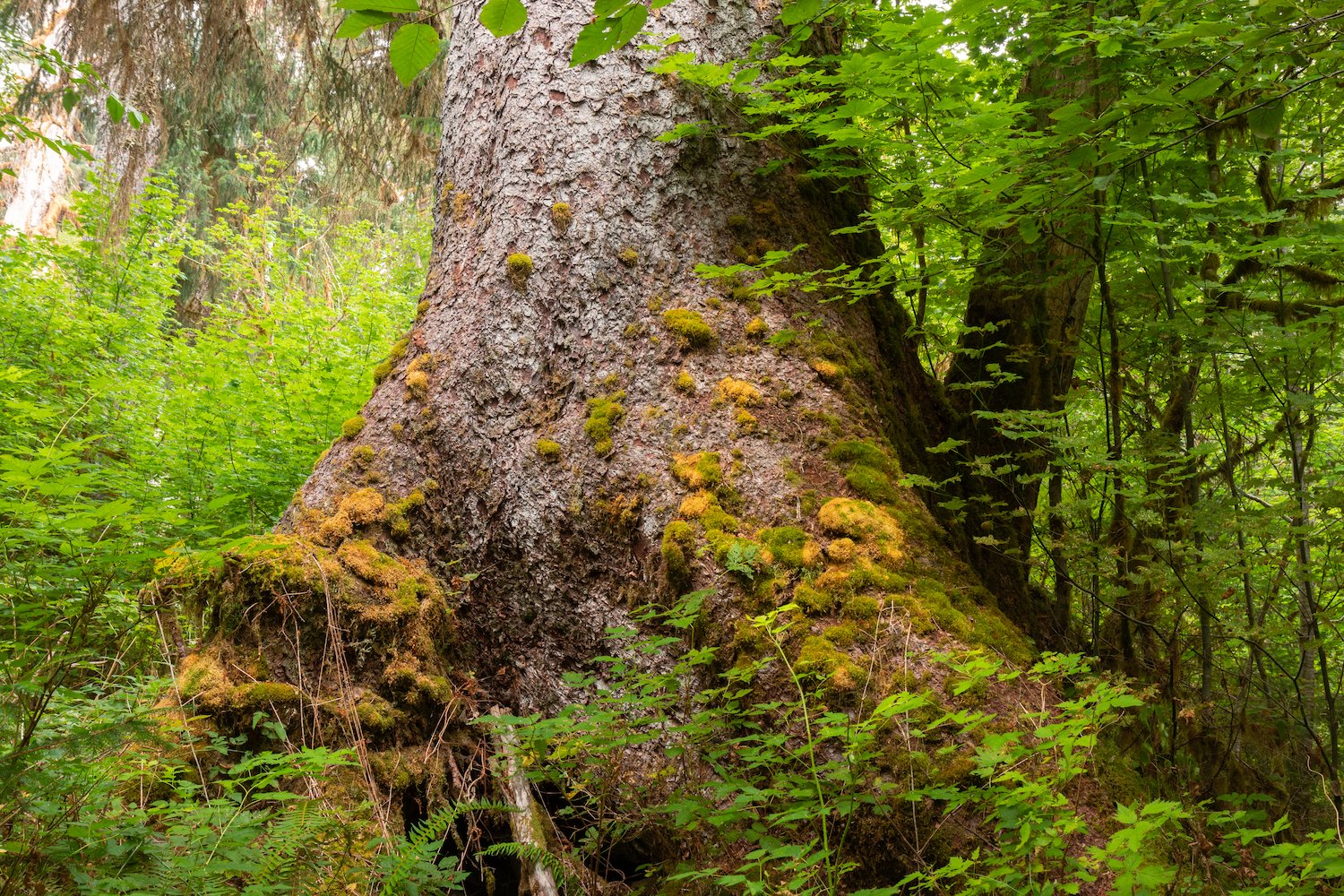
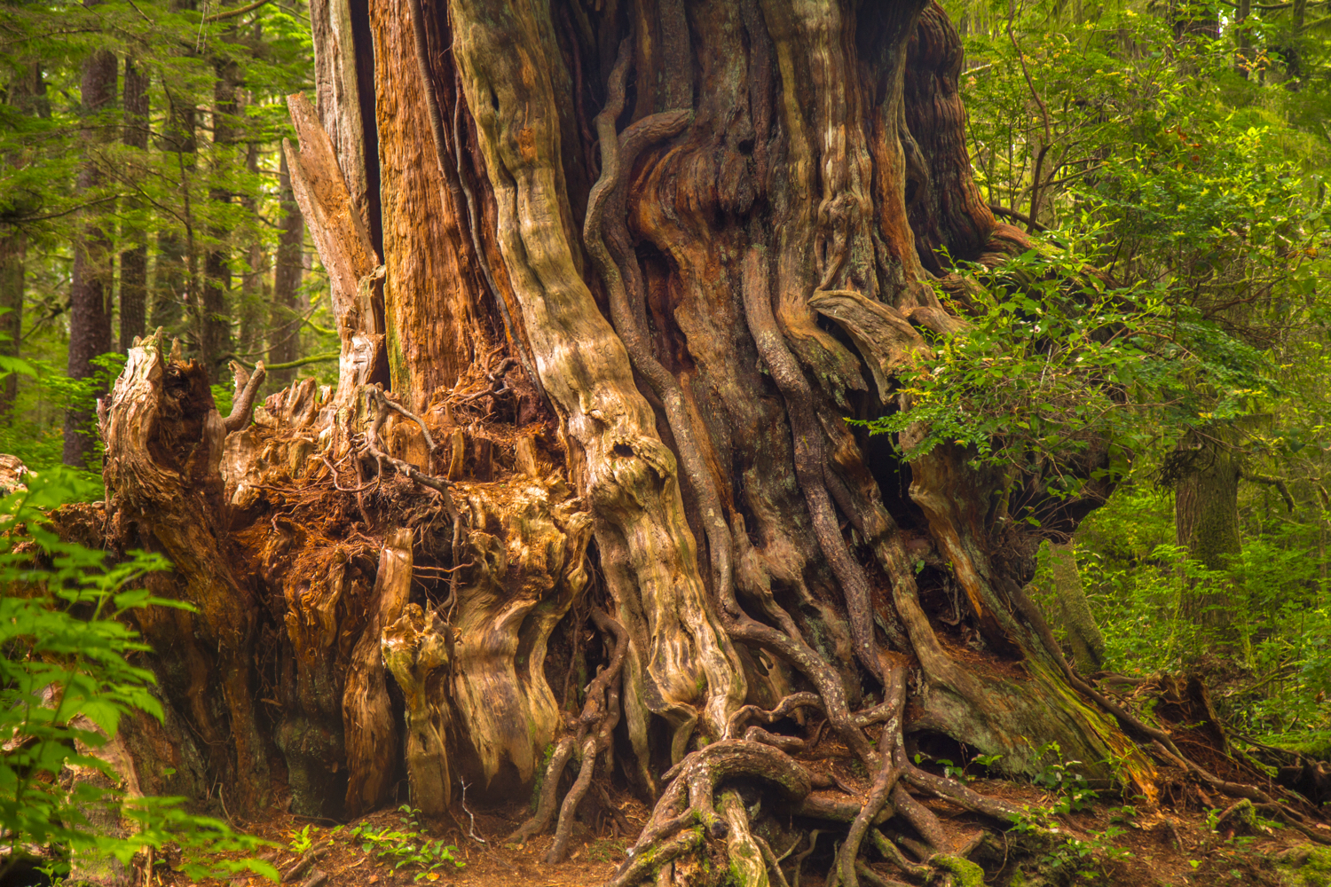
Preston Macy Sitka Spruce Tree
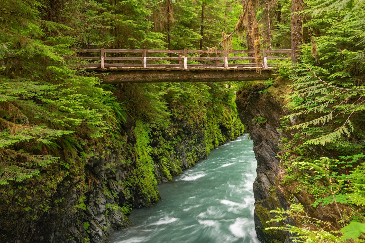
Hoh River Trail
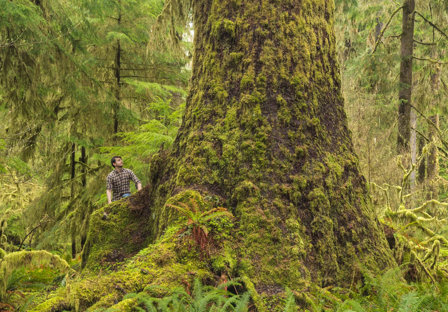
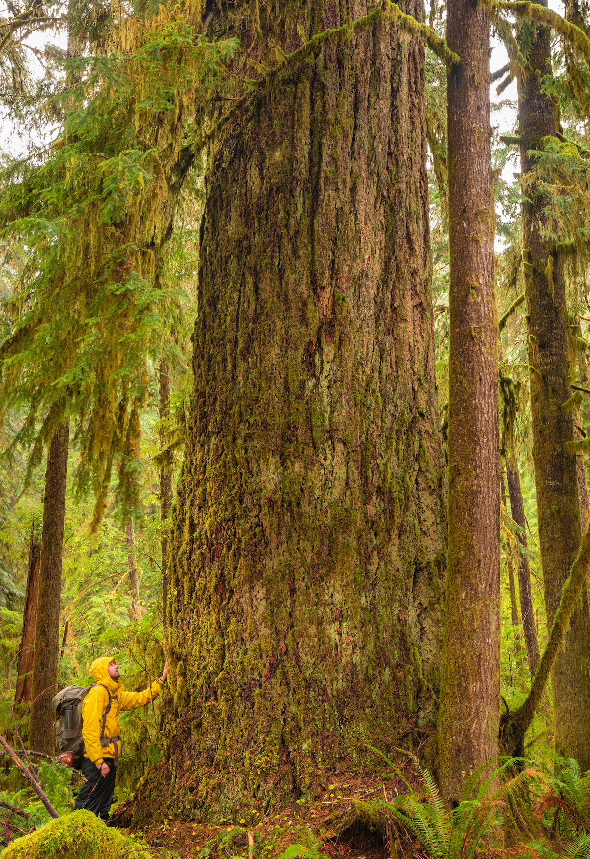
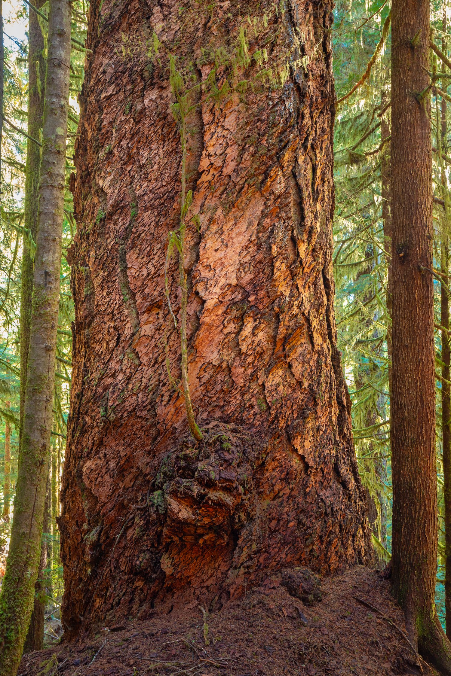
One of the greatest hikes in Olympic National Park and all of Cascadia, the Hoh River Trail is a 35-mile roundtrip excursion passing through outstanding Sitka spruce, Douglas fir, and western red cedar groves next to a glacially-fed river. Some of the old-growth trees here are hundreds of years old and reach gigantic proportions.
The trail travels toward the center of the Olympic Mountains, and unlike most rainforest hikes, the end features a hike into the mountains to a spectacular view of the Blue Glacier near Mount Olympus. For giant tree fans, the best part of the trail is the first 10 miles (one-way) to Olympus Ranger Station/Lewis Meadows. The station is a campground that serves as a great turnaround spot for those who wish to hike at a leisurely pace on an overnight backpacking trip.

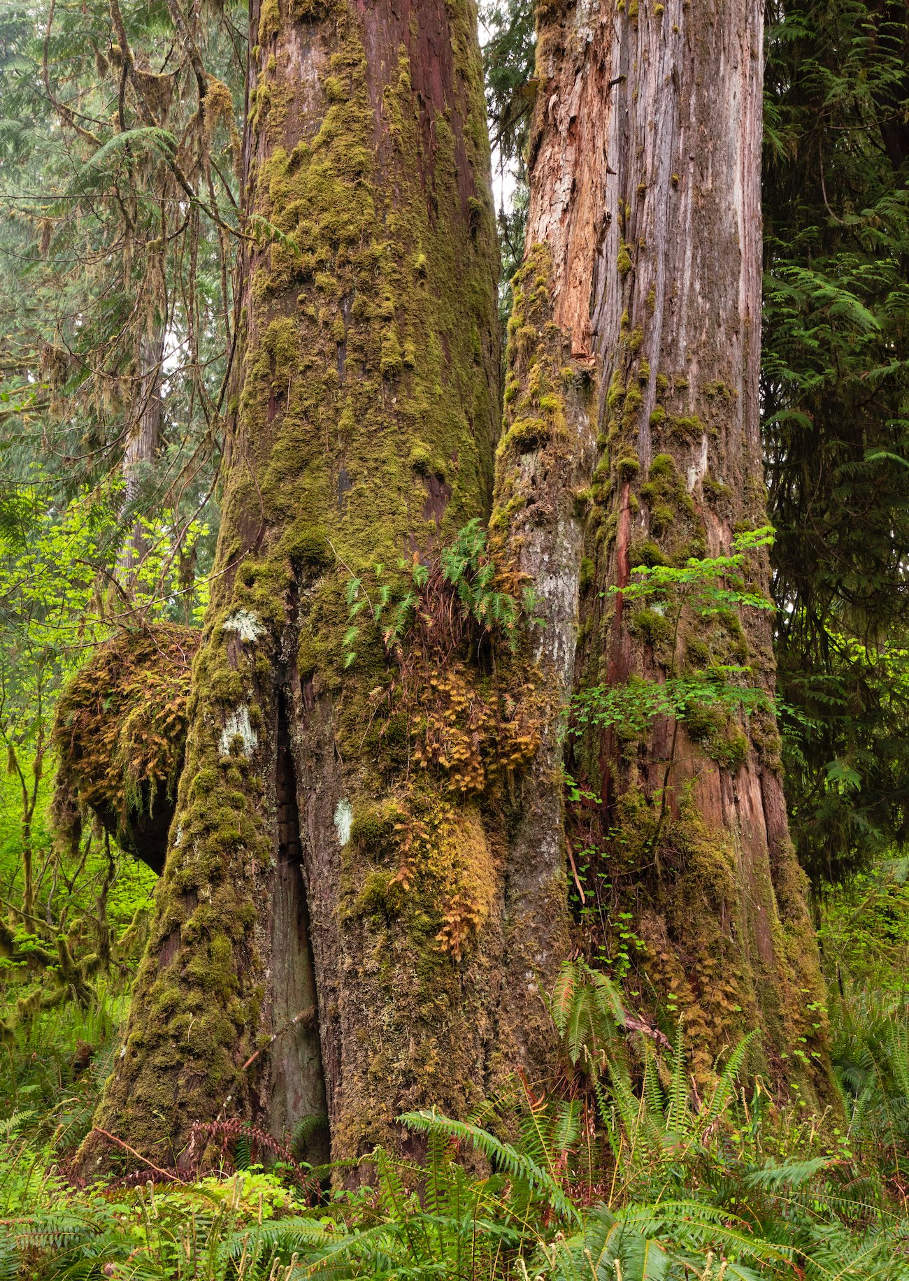
Cedar Grove

There are a few notable groves of enormous trees in those first 10 miles. One occupies the area around Cougar Creek (4-mile mark), where a small but stunning collection of massive western red cedars flank the trail on both sides. There doesn’t seem to be as many cedars on the trail as spruces, so this section is quite unique. Another, comprised of gigantic Sitka spruces, exists around the Happy Four Shelter, at around 6 miles. The trail here is dotted with giants sized around 10–12 feet in diameter at breast height as it reaches a plateau and moves away from the river. The last are the areas before and after Olympus Ranger Station (8–9-mile mark), where once again, ancient Sitka spruces dominate and grow to incomprehensible sizes.


South Fork Hoh River Trail
The South Fork of the Hoh River is formed by the Hubert Glacier on the south flank of Mount Olympus and flows west into the main stem of the Hoh River near the Olympic National Park boundary. While the Hoh River Trail is among the park's most popular hiking and backpacking corridors, the nearby South Fork Hoh River Trail sees a fraction of the traffic and offers genuine solitude in a pristine old-growth rainforest.


Both the South Fork Hoh campground and trailhead are reached at the end of a series of logging roads, where the transitions between private and protected lands remind travelers of the acute need to protect these forests. The trail begins by dropping down into newer forest before penetrating the Olympic National Park boundary. Here the environment takes on a more primitive and dense feel, with ancient-looking Bigleaf Maple trees adorned by moss sprinkled throughout. The path is also punctuated by grove after grove of gigantic Sitka spruces, often clustered in bunches. The whole trail feels wild, and even the campsites along the path (Big Flat and Stick-in-Eye) are primitive and overgrown. As primitive rest stops, these camps reinforce the experience of hiking deep into the South Fork Hoh wilderness.


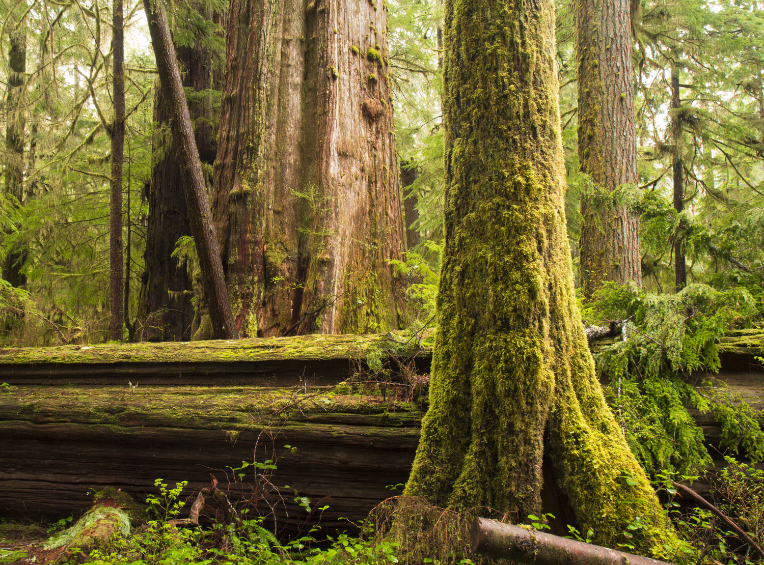
Quinault Rainforest
Perhaps the most accessible of Olympic National Park’s four rainforests, the major landmark in the Quinault is the lake, which contains beautiful old-growth forests accessible to hikers of all skill levels on both sides of its shore.
The north end of the lake is less developed and sees less foot traffic than the south, particularly after the tragic fall of the Quinault Big Cedar. The decommissioned trail to the cedar is still beautiful and populated with several giant trees.
Other than the fallen giant, the most notable hike on the north end is the unique Maple Glade Nature Trail, which, at a short 0.5 miles, traverses a dense grove of ornate Bigleaf Maple trees. These mossy trees grow in a swampy environment of still water that reflects the trees on windless days.

Lake Quinault North Shore

Quinault Big Cedar

Maple Glade Nature Trail
Maple Glade Nature Trail
Quinault National Recreation Trail System
The south end of Lake Quinault contains a number of short rainforest hikes originating near Lake Quinault Lodge. This area, which includes the Rain Forest Nature Trail, Gatton Creek Trail, Falls Creek, and others, combines to penetrate perhaps the greatest Douglas fir forest in the entire Pacific Northwest. Many of Olympic National Park’s biggest and tallest Douglas firs are located here, including Tichipawa, Gatton Goliath, Quamal, and Rex—all extraordinary, iconic trees.


Some of the best stands of fir grow on the southern end of the Gatton Creek Trail and along the Rain Forest Nature Trail, where the trees reach maximum height and width. In fact, big tree enthusiasts have identified a section of this rainforest as the "Miracle Acre"—a stand of 400-year-old trees so large and dense that it holds the regional record for weight of wood per acre.


enchanted valley
On par with the other major multi-day rainforest valley hikes in the national park, like the Hoh and Queets River trails, the Enchanted Valley is as epic as its name implies. For 12 miles (one-way), hikers parallel the banks of the Quinault River, passing massive tree after massive tree. Cedars, firs, spruces, and hemlocks—this valley has it all and is an amazing display of the type of ancient, old-growth forest that the weather on the Olympic Peninsula can produce. The areas around the backcountry camps, O’Neill Creek and Pyrites Creek, contain some magnificent groves and ancient specimens.

Pony Bridge

The hike terminates at the Enchanted Valley, otherwise known as the Valley of 10,000 Waterfalls, where vertical mountains surround a grassy open meadow. The meadow is home to the historic but closed Enchanted Valley Chalet, as well as black bears and Roosevelt elk. For pictures of the valley, check out the Olympic Mountains section of this guide.


Big creek trail
Underused and criminally underappreciated, the Big Creek Trail, located past the east end of Lake Quinault, is recognized for having the largest Alaska yellow cedar known. But the trail is much more than that. It boasts a stunning collection of massive cedars and Douglas firs. Miles two and three from the trailhead contain very large trees, some fused, some single-stemmed. After fording Big Creek, the trail begins to climb through a grove of impressively large Alaska yellow cedars, ending at the largest specimen of the group.


Largest Alaska Yellow Cedar

Largest Alaska Yellow Cedar
North Fork Quinault Trail
Nestled between the Enchanted Valley and Big Creek Trail, the path up the North Fork of the Quinault River is a classic low-elevation forest valley for its first 10 or so miles. I didn’t find the old-growth here to be as spectacular as that on the nearby trails profiled above, but then again, I only explored the first five miles of this hike. Further on, there are some stream crossings that can be challenging after heavy rains or during the spring melt.
The highlight of this initial section is an area about 1.7 miles from the trailhead and about halfway to Wolf Bar Camp, where the forest opens up in a flat section. Scattered about are huge western red cedars and bigleaf maples that flank the trail in a very scenic landscape. Most of the pictures here come from a grove that I found off-trail in this section.


Campbell Tree Grove
I would be remiss to close out the Quinault Rainforest section of this guide without mentioning the best campground in the region, though it is in an adjacent valley. The Campbell Tree Grove Campground is located along the West Fork Humptulips River and secluded far away from civilization. This grove contains stately, ancient Douglas firs on one side and scraggly, old western red cedars on the other. Though the detour to get there is long, I highly recommend sleeping at this campsite under the canopy of its giant trees.

Queets Rainforest
Queets River Trail
Because of its relative inaccessibility, the Queets receives a fraction of the tourists that travel to the Hoh, helping it retain its wilderness appeal. The rainforest is notable for some enormous trees, including the mossy Queets Spruce, one of the largest Sitka spruce trees in the world, and the Queets Fir, the thickest known Douglas fir. The Queets River Trail begins with a ford of the Queets River, an undertaking typically only safely manageable in late summer. As it travels deeper into Olympic National Park’s interior, it passes trees of magnificent size draped in ferns and mosses.

Queets Spruce

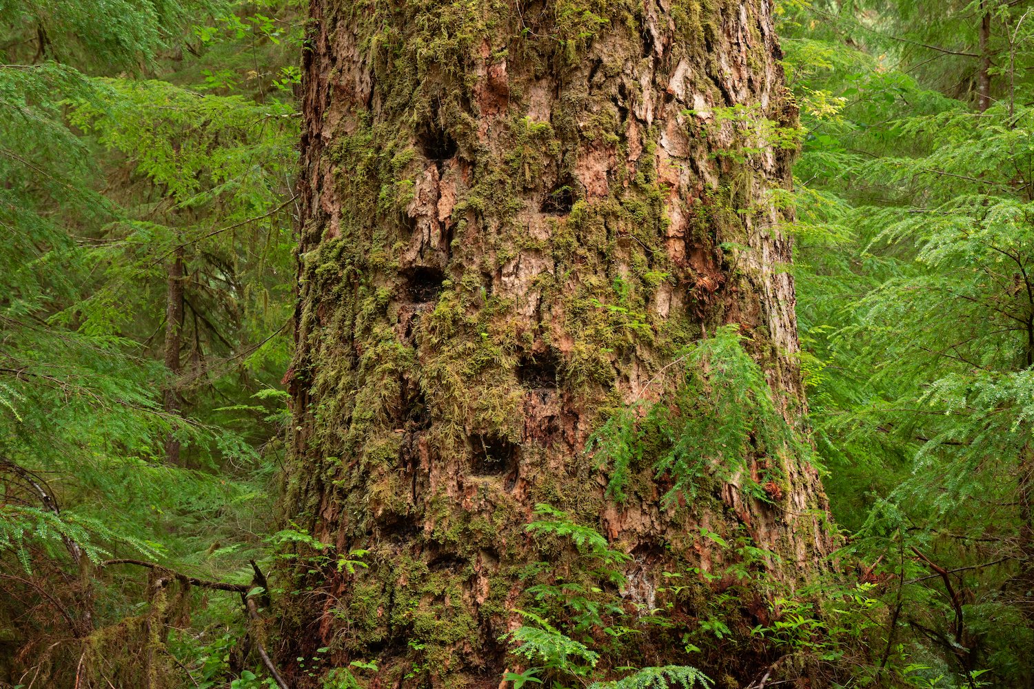
If one tree defines the Queets, it is the Sitka spruce. A number of massive spruces grow adjacent to and near the trail for its entire length. The valley holds one of the best collections of spruces on the Peninsula, and their size attests to their incredible age. Some are covered in moss, some are in the process of decay, but most are unique in appearance and shape.


Sam’s River Loop Trail
Though lacking the giant trees found across the river on the nearby Queets River Trail, the Sam’s River Loop Trail has a unique character all its own. This short 2.5-mile walk circumambulates the Queets Campground and ranger station, and is filled with moss-laden trees. Both exemplary bigleaf maples and western hemlocks enclose the trail, with draped flora hanging from every branch. Unlike many of the major river valley hikes elsewhere in the national park, this hike has a spacious, open feel to it, crossing beautiful fields of lush grass. There are at least two sections where the path disappears, and hikers must rely on signs across the grassy wetlands to find the trail’s continuation. Though brief, the trail is a wonderful and accessible introduction to the rainforest for those unwilling or unable to ford the river deeper into the Queets.


Bogachiel Rainforest
Ira Spring Wetland Loop
Circling a dense stand of old-growth Sitka spruce trees growing on a flat watershed, the Ira Spring Wetland Loop is a wonderful introduction to the Peninsula’s ancient forests. The loop is situated entirely in Olympic National Forest and leads to the National Park boundary.
The trail’s northern section rises above the watershed, passing a diverse mix of flora. However, the southern end, closer to the Bogachiel River, is where the true giant trees grow. These specimens are among the biggest in the park and have benefited from the perpetual saturation of the rainforest environment.
The loop is a short hike and a perfect day-trip alternative to the Bogachiel River Trail, a lengthy (often multi-day) overnight backpacking trek further inland.


Bogachiel Rainforest River trail
The Bogachiel—the northernmost and likely least visited of the four rainforest valleys in Olympic National Park—is an astonishing place of old-growth beauty. The only trail traversing the valley is the Bogachiel Rainforest River Trail, which begins east of the Ira Springs Wetlands Loop and ends at Sol Duc Hot Springs Road nearly 30 miles east. The path is also the western end of the 1,200-mile Pacific Northwest National Scenic Trail, which traverses three states near the Canadian border.
While it may not be one of Olympic National Park’s most famous rainforest trails, the Bogachiel provides plenty of adventure as hikers must cross many small creeks that flow from the hillsides, over the trail, and down into the Bogachiel River. Throughout its length, the trail passes through open grassy maple tree grasslands and dense hemlock, fir, and spruce forests, while occasionally offering views of the beautiful river to the south. For big tree fans, it may be hard to deny that this rainforest contains one of the greatest collections of gigantic Sitka spruce anywhere. A few of the trees pictured here are examples of ancient spruce whose sizes attest to the fertile, hospitable nature of this beautiful river valley.


Rugged Ridge (Indian Pass) Trail
Stemming off the Bogachiel River Trail, the little-known and seldom-used Rugged Ridge/Indian Pass Trail is not particularly notable except to insider big tree enthusiasts, as it contains a grove of enormous, ancient Douglas firs. The giants are located off-trail about two miles north of the Bogachiel Trail on a small knoll, and only experienced hikers should venture to explore them. The largest is named the "Indian Pass Tree," measuring nearly 12 feet in diameter—a real wall of wood!

Indian Pass Tree
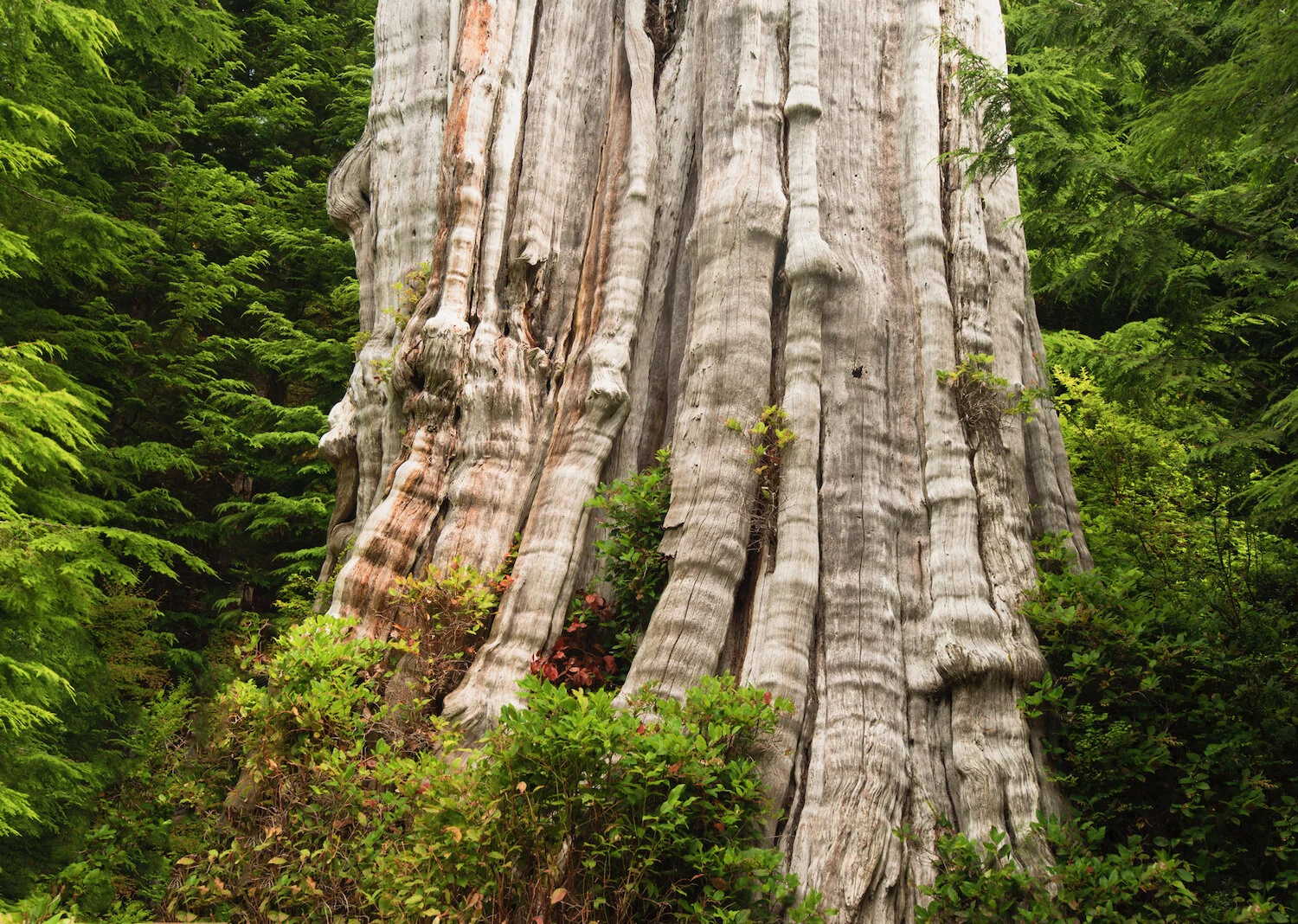
Kalaloch Big Cedar
Kalaloch Big Cedar
With the abundance of rain and constant mist generated by proximity to the Pacific Ocean, several western red cedar trees in the park’s western end reach record sizes. One famous, ancient tree clearly illustrates this phenomenon.
The Kalaloch Big Cedar is perhaps one of the gnarliest trees in the region. Its base is covered with interlocking arms of wood extending from its roots up through the trunk. The Kalaloch was already a strange-looking tree before a violent storm in 2014 ripped it in half, disfiguring it even further. The fact that it is still standing underlines how strong and durable these giants are.
The Duncan Cedar & Grove
A far more traditional-looking western red cedar than the Kalaloch Big Cedar is another coastal giant that goes by two names: the Duncan Cedar and/or Nolan Creek Cedar. It stands among clearcut land that was leveled long ago, leaving the tree exposed to the sun for years. The exposure has bleached its massive trunk to an off-white color, helping it stand out from the surrounding newer, green forest. With the fall of the Quinault Big Cedar by Lake Quinault, the Duncan Cedar was crowned Washington’s largest cedar.
There is also a small patch of old-growth forest on the drive to the Duncan Cedar, preserved among a second-growth exterior. It is located about two miles from Highway 101, and the entrance is only marked by a drawing of a tree that points to a boardwalk trail across the road. Very few visitors explore it or know about it, so it has retained a particularly wild feel. The very short trail leads to a few big trees, some 8-9 feet in diameter at breast height.
Duncan Cedar (aka Nolan Creek Cedar)
Duncan Cedar Grove

Duncan Cedar Grove
Lake Crescent
Beautiful Lake Crescent in the northern section of the Olympic Peninsula is surrounded by old-growth forests primarily of Douglas fir and bigleaf maple. Highway 101 (Olympic Highway) runs along the southern border and provides great sightlines into the lake and surrounding hillsides. At its west end, Camp David Jr. Road branches off from the main highway and traverses spectacular groves and leads to a boat launch where many beautiful trees are located.
The pictured giant bigleaf maple stands alone near Lake Crescent in a clearing exposed to the wind, rain, and elements. As is typical of bigleaf maples, moss has grown on virtually all of its huge branches. It is a great example of how important these trees are as a host to other plants, ferns, lichen, and other organisms.
Other enormous trees are encountered on the short trail to Marymere Falls, profiled in this gallery. Adjacent to the path, there are a solid half dozen massive cedars and a few Douglas firs, including the one pictured here.

Lake Crescent Bigleaf Maple

Marymere Falls Giant Douglas Fir
Shady Lane Trail & Staircase Rapids Loop
Where the North Fork Skokomish River flows into Lake Cushman in the southeastern section of Olympic National Park, hikers can expect to find a combination of old-growth forests, waterfalls, and river rapids. Beginning at the Staircase Ranger Station, the Shady Lane Trail follows the river at its southern end and passes through some large, unique trees. For fans of giant trees, this is the trail that dominates over the others in the region. It’s only two miles long, and the trail is overgrown in portions, but the trees are ancient, and the forest is rich in diversity. The Staircase Rapids Loop, on the other hand, north of the ranger station, follows the North Fork Skokomish on both its east and west banks. There are some large trees on this trail, but they pale in comparison to the ones on the Shady Lane Trail. The main attraction here is the various views of the river as it cascades down, forming multiple waterfalls along the way.
Nearby, one of the best groves of moss-laden bigleaf maple is encountered on the Beaver Pond Trail. As its name implies, the pond that this short trail circles is a haven for beavers and an assortment of birds. However, the maples on the western end of the loop (around halfway) are staggering in their size and height.


Staircase Rapids Loop


Beaver Pond Trail

Spruce burl trail
Perhaps one of the strangest groves of trees on the Olympic Peninsula, the spruces on a side path to Beach 1 are leafless and windswept, and have grown massive burls up and down their stems. The growths are mysterious yet thought to be benign. The burls are enormous compared to the relatively small and skinny sizes of the trees they grow on. The loop trail is a fraction of a mile, but spruce burls are found all along the coast, especially farther north from the trail for those seeking an easy off-trail adventure.


Ancient Groves Nature Trail
Travelers on the way to the Sol Duc Falls trailhead can explore a flat 0.4-mile round-trip trail right off the road that weaves through an awesomely verdant and mossy forest. The trees on the Ancient Groves Nature Trail aren’t particularly large or wide, but they exist in a very scenic setting. Like most old-growth forests, the area is best visited during the winter or early spring, when the forest floor explodes with green. During these rainy months, the precipitation collects in dark pools between the trees and forms photogenic swampy conditions.


Long Island/DOn Bonker Cedar Grove
Long Island, located in the southwest corner of Washington State, contains the greatest concentration of giant western red cedars in western Washington outside of Olympic National Park. As part of Willapa National Wildlife Refuge, the island has no roads or road access, helping to preserve its wonderful collection of old-growth.


The cedars are part of the 274-acre Don Bonker Cedar Grove, situated in the middle section of the island. As they have for nearly 1,000 years, these giants rise like titans in a forest of dense vegetation. A very short loop trail takes hikers into a small section of the grove, crossing trees in various states of growth and decomposition. Some of the oldest specimens testify to ancient fires that burned through here long ago.
The largest and most impressive trees, however, are not located near the official trail but rather about 1/4 of a mile south in a stand that clings to a hillside. The massive cedars in pictures three and five both grow in this region and are among the absolute largest. Getting close to them is difficult, however, because it requires intense bushwhacking.
Perhaps the island’s most charming characteristic is the fact that its official trail is completely carpeted by grass. This, combined with the fact that many trees here are contorted into strange shapes, gives one the experience of hiking through a lush "Lost World."