Salar de Uyuni
Stretching over 10,000 square kilometers at the heart of the Bolivian Altiplano, Salar de Uyuni is the largest salt flat on Earth—an otherworldly expanse of blinding white hexagons that once formed the bed of a vast prehistoric lake, Lake Minchin. At over 12,000 feet above sea level, the air is thin, the sun unfiltered, and the light strikingly pure, amplifying every texture and shadow. The salt crust crunches underfoot like fresh snow, and in the dry season, the polygonal patterns stretch toward the horizon in hypnotic repetition. With no vegetation or landmarks to break the line of sight, the scale of the place becomes hard to grasp—it feels endless, silent, and alien. Despite its desolate appearance, the Salar plays a vital ecological role and holds one of the world’s largest reserves of lithium beneath its surface.


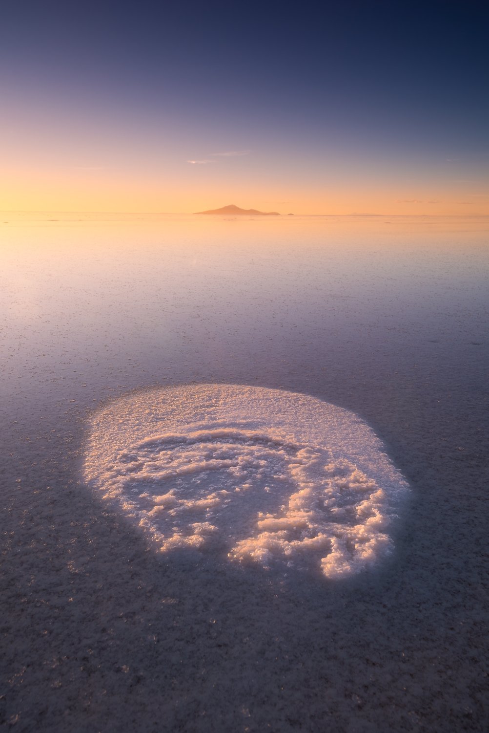

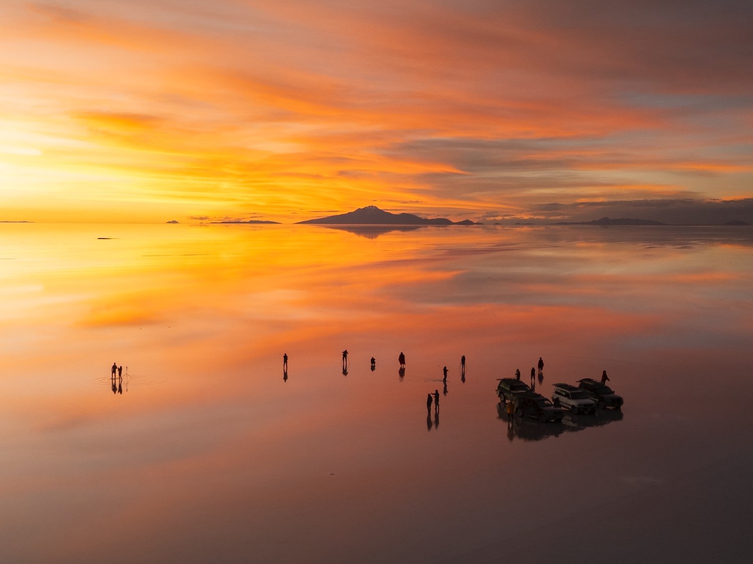

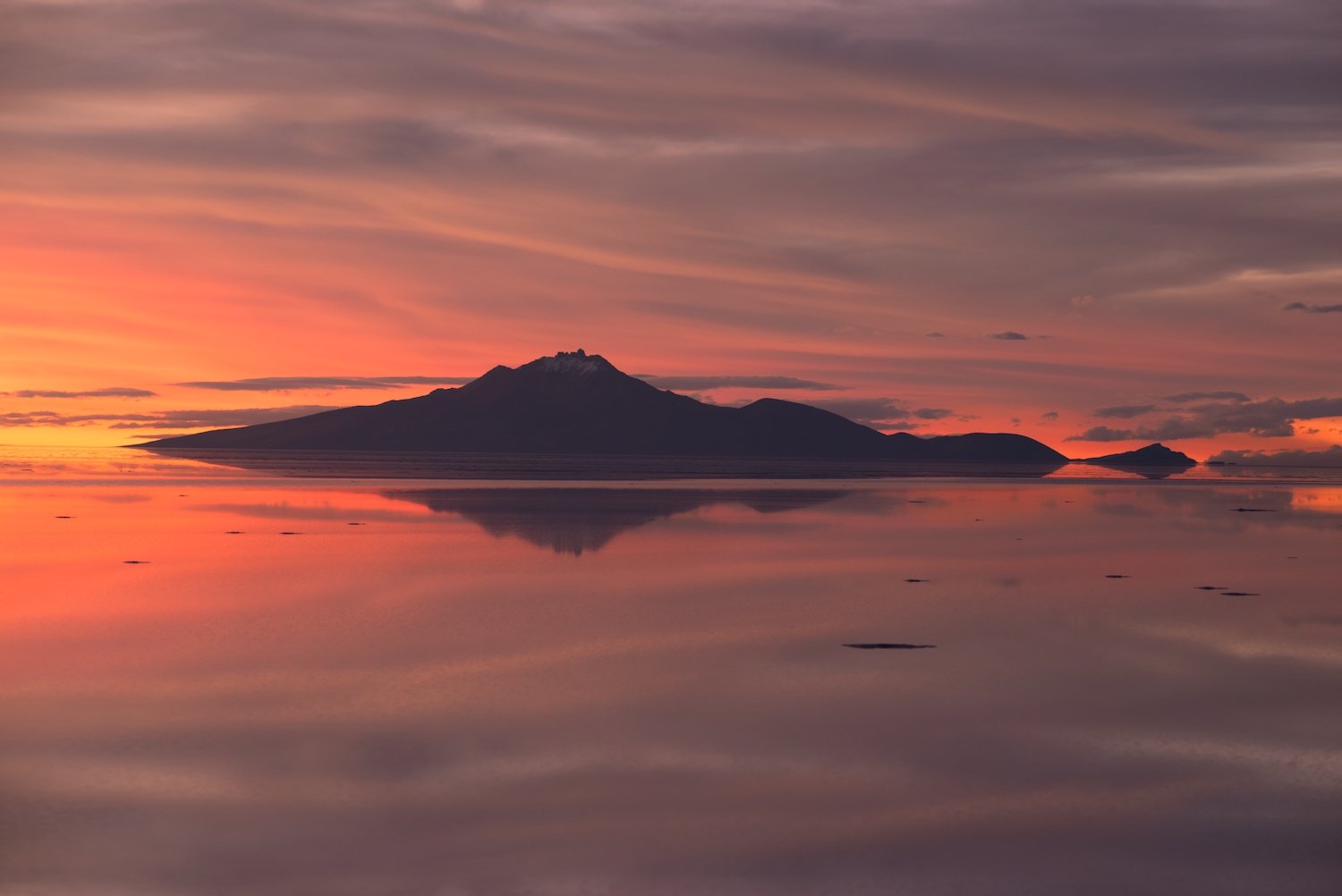
In the rainy season, a thin layer of water pools across the salt crust, transforming the Salar into a flawless mirror that perfectly reflects the sky. The boundary between earth and sky dissolves, creating a horizonless world where clouds drift below your feet and stars appear to surround you at night. By day, it feels like walking through the sky itself, a vast floating expanse that tricks the senses. Flamingos wade through the reflections, and distant travelers seem to hover midair. At sunset, the landscape melts into shimmering bands of gold, rose, and deep violet, doubling the drama of the sky above.

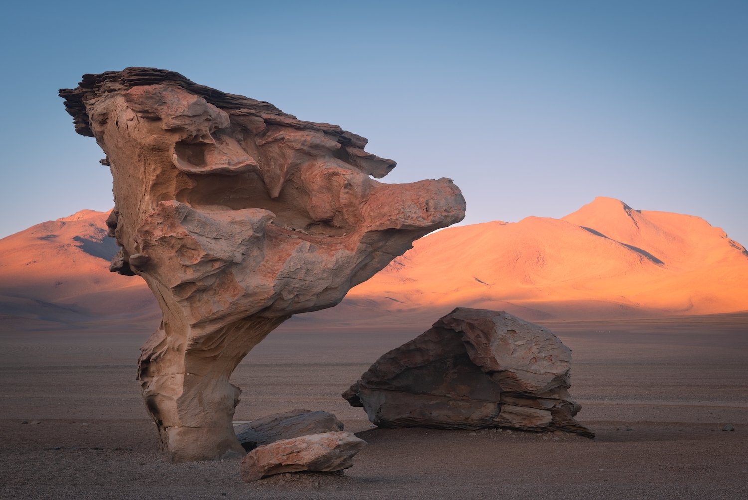
Valle de las Rocas
Located in the southwestern Bolivian Altiplano, Valle de las Rocas is a high-altitude desert filled with massive volcanic rock formations sculpted by wind and time. The boulders, some balanced in impossible shapes, rise abruptly from the flat, arid terrain, creating a stark and dramatic landscape. At sunset, the rocks take on a deep red hue, glowing against the fading light and casting long shadows across the valley floor. It’s a quiet, rugged place that feels both remote and timeless. Nearby, “Italia Perdida” - a similar landscape - features a maze-like cluster of eroded rock towers and passageways, resembling ancient ruins scattered across the high desert.


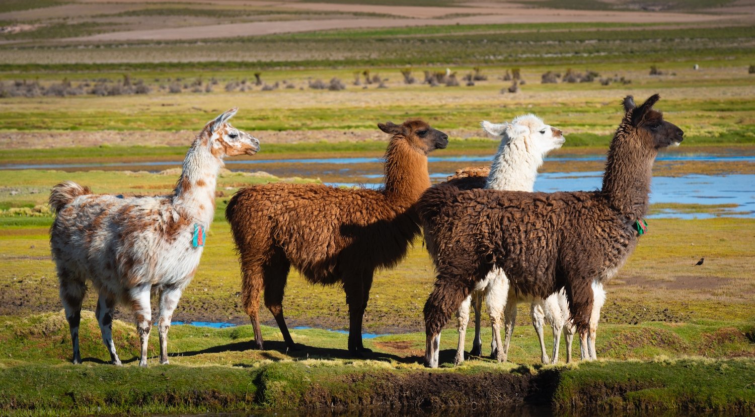
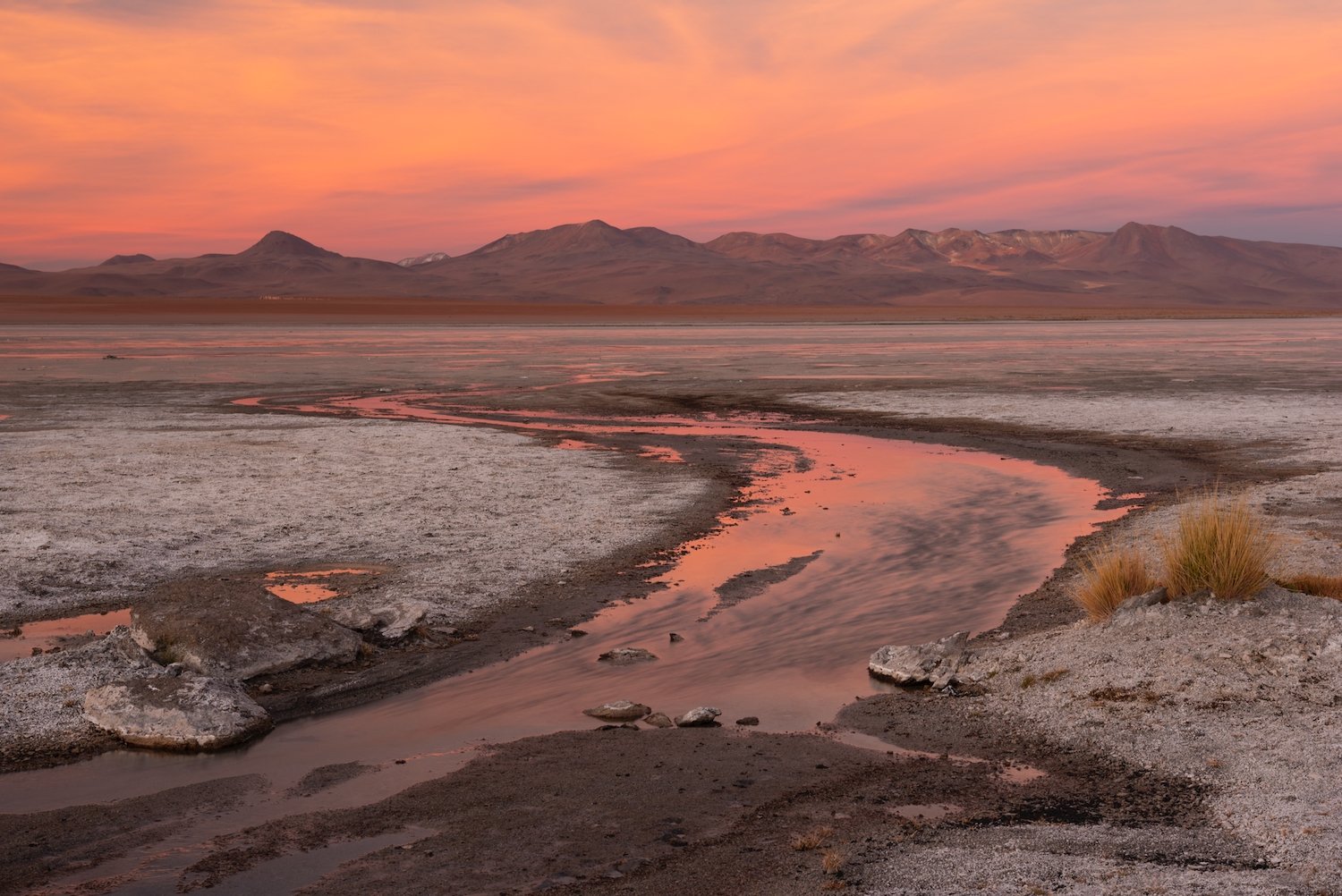
Laguna Pastos Grandes & Laguna Hedionda
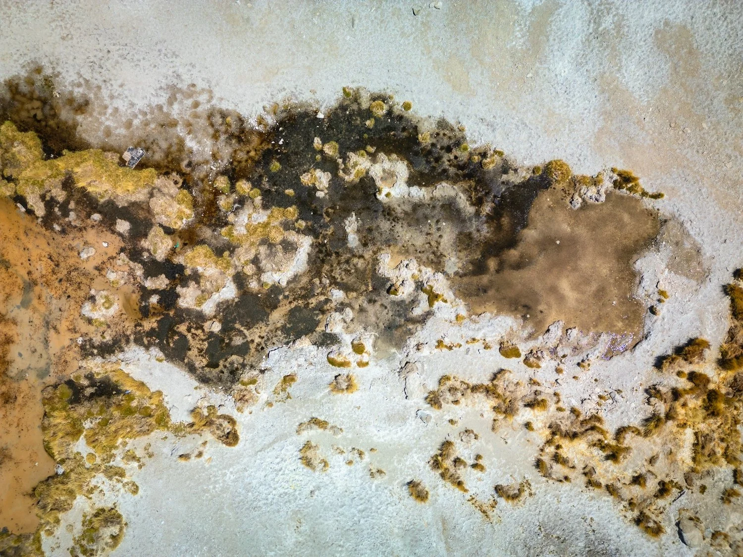
Situated in the remote highlands of Bolivia’s Potosí Department, Laguna Pastos Grandes is a sprawling salt lake set within a massive volcanic caldera at over 4,400 meters above sea level. Its mineral-rich waters and shoreline give rise to subtle colors and textures that shift with the light, and its surroundings are dotted with thermal springs, salt crusts, and distant volcanic peaks (including the imposing Chulluncani). From above, drone photography reveals intricate natural patterns—networks of mineral flows, shifting shorelines, and cracked salt flats—that aren’t visible from the ground, offering a unique perspective on the lake’s geological complexity.
Just northwest, Laguna Hedionda offers a contrasting but equally captivating scene. Known for its high concentrations of borax and sulfur, the lake supports large populations of flamingos, whose pink forms wade through shallow, mineral-rich water framed by pastel hills and snow-dusted ridgelines. While Pastos Grandes feels serene and expansive, Hedionda feels alive with motion and color—especially in the early morning light.
When I visited Pastos Grandes, a pack of llamas were grazing on the short grasses—including the one pictured here. The wind held still and the llama was framed by the reflected view of Chulluncani, a rugged volcanic peak that rises along the lake’s northwestern shore. Standing at approximately 5,768 meters (18,923 feet), Chulluncani is part of the Cordillera Occidental and towers above the salt flats and mineral-rich waters of Laguna Pastos Grandes. Its sharp silhouette and occasional snow cap make it a striking presence, especially when mirrored in the glass-still surface of the lake.

Laguna Pastos Grandes (from above)

Laguna Pastos Grandes & Chulluncani Mountain

Laguna Hedionda
Cañon de Alota
Wildlife enthusiasts should make time for two standout locations in the Bolivian Altiplano: Laguna Kara and the Cañon de Alota. Laguna Kara is known for hosting some of the highest concentrations of flamingos in the region, with large flocks gathering in its shallow, mineral-rich waters—especially striking against the stark backdrop of the surrounding mountains. Nearby, the Cañon de Alota offers a different kind of spectacle. Carved through volcanic rock, this narrow canyon shelters a bofedal—a high-altitude wetland fed by underground springs. These lush, marshy patches are rare in the dry Altiplano and serve as vital grazing grounds for wildlife. At Cañon de Alota, packs of llamas and alpacas often gather to feed on the grasses, offering excellent chances for close-up wildlife photography in a dramatic setting.
Eduardo Avaroa National Reserve
Árbol de Piedra & Salvador Dalí Desert
Árbol de Piedra ("Stone Tree") is one of the most recognizable rock formations in the Eduardo Avaroa National Reserve. Shaped by relentless wind erosion, the freestanding volcanic rock stands about 7 meters tall, its narrow base giving way to a wide, sculpted crown that resembles a windswept tree. It sits in the Siloli Desert, a barren expanse of sand and scattered boulders near the northern edge of the reserve. Not far from here, in the Salvador Dalí Desert, similarly isolated stone monoliths rise from the plain—named for their resemblance to the surreal, dreamlike landscapes painted by Dalí. These formations can only be seen from a distance (due to their protected status) standing alone in the empty terrain, and add to the sense of vastness and stillness that defines the southern Altiplano.
Árbol de Piedra

Salvador Dalí Desert
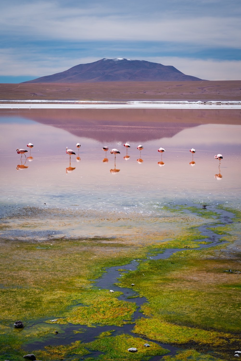
Laguna Colorada
Laguna Colorada is one of the Altiplano’s most iconic and surreal landscapes—a shallow salt lake tinged deep red by algae and mineral sediments. At nearly 4,300 meters above sea level within the Eduardo Avaroa National Reserve, its crimson waters shift with the light, appearing brightest at midday and softening into dusky rose as the sun sets. The lake is dotted with white borax islands and framed by windswept volcanoes, giving it an otherworldly, painterly look that feels almost unreal. It's also a key breeding ground for James’s flamingos, which gather here by the hundreds, their pink silhouettes standing out against the rusty reds and stark whites of the lakebed.
I was fortunate to photograph Laguna Colorada from two remarkable vantage points. The first was from a peninsula extending off the southern shore, where the midday light revealed dramatic contrasts—bold layers of white salt and deep red water unfolding in intricate, painterly patterns. The second was from the northern shore at sunset, where the lake softened into warm tones, glowing gently beneath a sky brushed with pastel clouds, the colors of the landscape and sky blurring into a quiet, dreamlike scene.


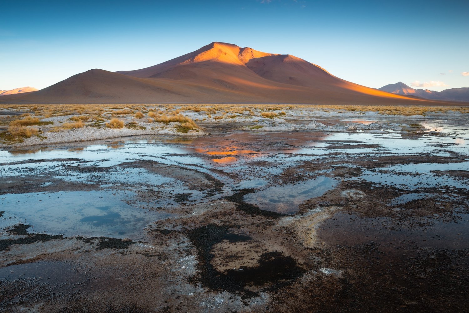
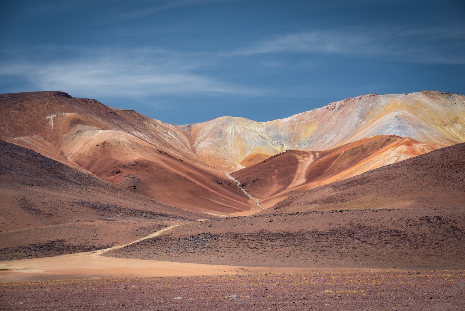
Salar de Chalviri & Laguna Polques
Located south of Laguna Colorada within the Eduardo Avaroa Andean Fauna National Reserve, Salar de Chalviri and Laguna Polques form one of the most visually intricate and geologically active areas of the Altiplano. This high-altitude salt flat and shallow lagoon are fed by thermal springs, creating mineral-rich wetlands that support clusters of vegetation and draw herds of grazing vicuñas and llamas. From above, the landscape reveals abstract patterns—swirls of dark mud, white salt crusts, and tufts of green grass scattered across a pale backdrop. These details are subtle at ground level but come alive in aerial views, where textures and tonal shifts turn the surface into a living map.
Salar de Chalviri
Salar de Chalviri
The area is at its most photogenic during sunset, when the last light of the day casts golden tones across the landscape and reflects off the thermal pools. Just beyond, the colorful foothills and mineral-streaked slopes of nearby mountains—like those seen in the final photo below—rise in bold bands of red, orange, and yellow. These painted hills complete the surreal palette of this remote corner of the reserve, making it a prime location for both photography and quiet observation.
Laguna Polques (from above)
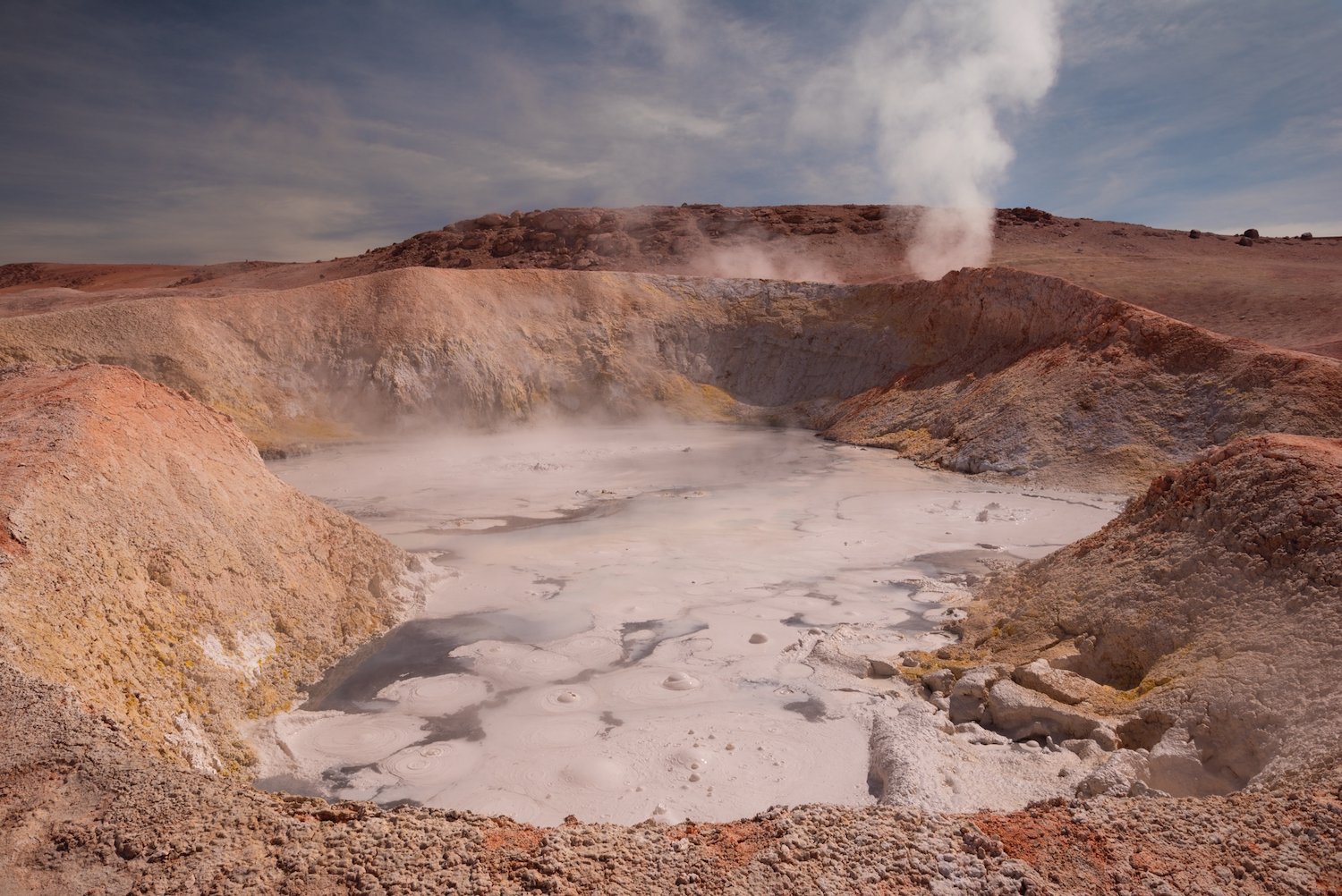
Sol de Mañana
Sol de Mañana is a geothermal field located at approximately 4,900 meters (16,076 feet) above sea level in the southwestern corner of Bolivia, within the Eduardo Avaroa Andean Fauna National Reserve. This high-altitude basin is known for its intense volcanic activity, with boiling mud pools, steaming fumaroles, and powerful geysers that release jets of steam up to 50 meters into the air. The landscape is otherworldly—marked by sulfur-stained earth, bubbling craters, and a constant hiss of escaping gas. Temperatures underground can reach over 200°C (392°F), and the field is most active in the early morning hours when the cold air heightens the visibility of the steam columns.

Sol de Mañana (from above)


Laguna Verde
Laguna Verde is a striking salt lake located at the southern tip of the Eduardo Avaroa Andean Fauna National Reserve, near the Chilean border and nestled at the foot of the iconic Licancabur Volcano. The lake is best known for its vivid green color, which can range from turquoise to emerald depending on the light, wind, and mineral concentration. This unusual coloration is caused by high levels of arsenic and other minerals suspended in the water, along with the lake’s extreme salinity.
Sitting at an elevation of around 4,300 meters (14,100 feet), the lake is often whipped by strong winds that help stir the mineral-rich waters and intensify the color. I know, because I almost lost my drone to these winds!
Although the lake appears inviting, it is highly toxic and supports little visible life. Its remote location, stark beauty, and surreal colors make Laguna Verde a favorite stop for travelers exploring the southern Bolivian Altiplano.
Valle de la Luna
Located just a short drive from La Paz, Valle de la Luna (Valley of the Moon) is a surreal geological landscape formed by centuries of erosion. The valley is made up of tall, thin spires and eroded clay formations that resemble a jagged lunar surface, giving the site its name. The terrain was shaped by wind and water gradually wearing away the soft earth, leaving behind a maze of canyons, columns, and narrow ridges.
Though the formations are largely beige and gray, the scene shifts dramatically with the light. In the late afternoon, when the sun is lower in the sky, the spires glow with warm tones—golden, rust, and rose—casting long shadows that highlight the texture and depth of the valley. A network of trails allows visitors to explore the formations up close, offering both sweeping views and intimate details of this unique, otherworldly landscape.

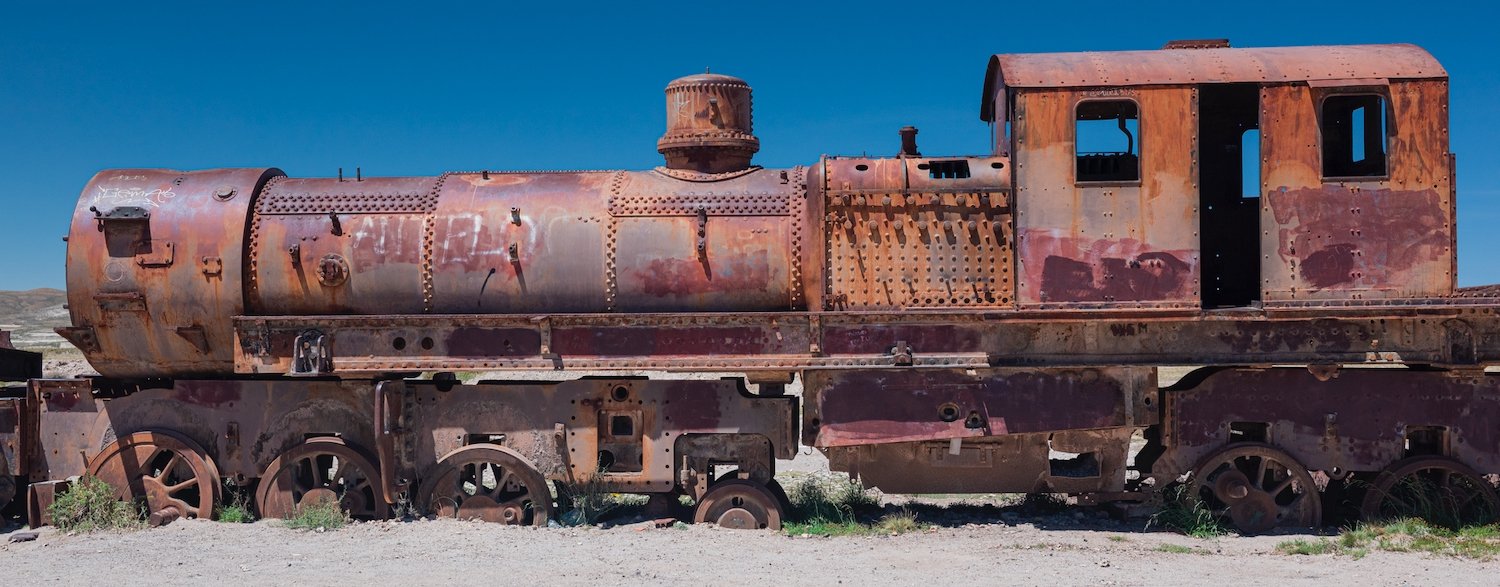
Uyuni Train Cemetery
Just outside the town of Uyuni lies the Train Cemetery, a striking contrast to the natural landscapes of the Altiplano. This collection of rusting locomotives and railcars dates back to the early 20th century, when Uyuni was a key hub in Bolivia’s ambitious railway network, intended to connect mineral-rich regions to the Pacific. When the mining industry declined and rail expansion stalled, dozens of trains were abandoned on the edge of the desert. Over time, the dry, salty air preserved the metal frames, leaving behind a surreal open-air graveyard. Though different in character from the surrounding natural wonders, the site is a reminder of the region’s industrial past and offers a curious glimpse into how the human footprint has faded into the high desert.